
This is a 1 ¼ mile (2 km) circular route, starting and finishing at the Village Hall. It takes in many of Stinchcombe’s listed buildings and other landmarks. Most have featured, or will feature in coming months, in articles in the Our Virtual Village section. If the walk whets your appetite for historical information, read more there.
We hope that you enjoy the walk!
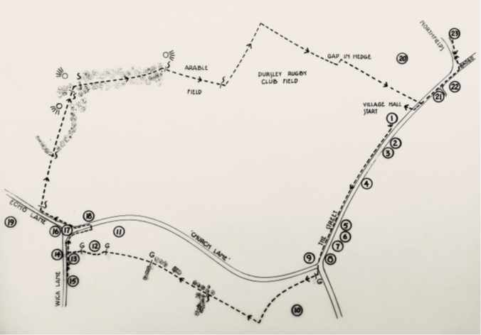
Map
All maps for the walk have been created by Stinchcombe resident John Pinch. A large-scale copy is available for viewing in the telephone box at Point 2 on the route, while the original is displayed in the Village Hall.
Important
The houses on the route are private homes – please respect the privacy of the occupants at all times. We ask you not to stray from the public rights of way to get a better view. In some cases your only view of a property will be a distant one.
On the off-road sections you must stick closely to the footpath and keep your dog on a lead. There will be livestock in some of the fields.
Please leave no litter and clear up any dog mess.
Walking Notes
The walking notes combine directions with some of the history of points of interest on the route.
They are available in two formats:
Mobile-friendly if you want to read them directly from your phone as you do the walk and Mobile Map
Printer-friendly if you prefer to print off a copy at home (10 pages including map and illustrations)
Accessibility
The route follows public footpaths and roads, including sections without pavements. It features some stiles and one fairly steep off-road stretch that may be slippery. This hill and all but one stile can be bypassed by using the shortcut described in the walking notes.